Geospatial Health: interdisciplinary approaches for advancing global health
special session as part of the European Congress for Tropical Medicine and International Health 2025, HAMBURG, Germany 29 september - 2 october 2025

Dear Colleague,
The 18th International Symposium on Geospatial Health, is scheduled as a special session within the larger European Congress for Tropical Medicine and International Health (ECTMIH 2025), which will take place in Hamburg, Germany from 29 September - 2 October.
The leading title of our session is ‘Geospatial Health: interdisciplinary approaches for advancing global health'.
Session introduction and objectives. Geospatial health is an interdisciplinary field that integrates geographic information and spatial analysis with health research to study the relationships between environmental, social, and geographic factors and health outcomes. It leverages tools like Geographic Information Systems (GIS), remote sensing, and spatial statistics to map disease patterns, track infectious diseases, assess healthcare access, and analyze the impact of environmental and climatic conditions on public health. Moving from an initial focus on infectious and vector-borne diseases, it now covers a wider array of health topics, including lifestyle, health promotion, well-being, non-communicable diseases, and health systems and policy. The discipline has also shifted from basic reporting and mapping to modelling complex pathogen-host-environment interactions, including forecasting of climate-induced health risks. This shift has further strenghthened its capability to support decision-making for disease prevention, resource allocation, and health policy. Its interdisciplinary and solution-oriented nature aligns well with global health perspectives, such as One Health and Planetary Health.
Participants in this session will gain insights into cutting-edge research in geospatial health, presented by renowned scientists from diverse disciplines, each offering unique perspectives. Below we present a detailed overview of the session structure and content.
SpeakerS | Presentation title | Brief introduction |
|---|---|---|
Swiss Tropical and Public Health Institute (Swiss TPH), Director, Professor in Epidemiology | The Swiss TPH perspective on Geospatial Health applications | Jürg Utzinger is the Director of the Swiss Tropical and Public Health Institute (Swiss TPH) and Professor of Epidemiology at the University of Basel. His research, teaching and training interests pertain to the epidemiology and integrated control of neglected tropical diseases and health impact assessments of large footprint projects in low- and middle-income countries. |
Department of Veterinary Medicine and Animal Production, University of Naples Federico II, Professor of Parasitology and Parasitic Diseases. | Multi-actor perspectives in parasite diagnosis and epidemiology | Laura Rinaldi is Full Professor of Parasitology and Parasitic Diseases. Co-founder and Associate Editor of the Journal Geospatial Health. Director of the WHO Collaborating Centre for Diagnosis of Intestinal Helminths and Protozoa. Main research focus is on epidemiology (using geospatial tools), diagnosis (using traditional and innovative techniques) and control of protozoa, helminths and artropoda of veterinary and human interest. |
Faculty of Geoinformation Science and Earth Observation, University of Twente, Professor Geohealth | Tackling multi-dimensional health risks with geographic information and geospatial technologies: vector-borne diseases to disaster epidemiology. | Justine Blanford is Full Professor of GeoHealth at University of Twente. Her research intersects epidemiology with geography and is centred around three main facets that include (i) risk: understanding where and when health risks are, the mechanisms driving risk (why) and who may be affected; (ii) prevention: what response and actions are needed; and (iii) communication: what to communicate. |
Institute of Global Health, Faculty of Medicine, University of Geneva, Head of Division of Human, Animal, and Environmental Health | Realistic accessibility modelling for better health system planning | Nicolas Ray is Associate Professor at the Institute of Global Health of the University of Geneva, heading the GeoHealth group and the development of the AccessMod software. He has long-standing inter-disciplinary research experience in spatial ecology, spatial data infrastructure, GIS, and geohealth, with a focus on models of physical accessibility to health services in low- and middle-income countries. |
Faculty of Geoinformation Science and Earth Observation, University of Twente, Associate Professor Water, Health and Decisions | Integrated social, geographical, medical and technological approaches to understand health challenges and opportunities of vulnerable population groups. | Carmen Anthonj is Associate Professor and Chair of Water, Health and Decisions at the University of Twente. She mixes methods rooting in social science with participatory mapping, co-design, and integrated knowledge translation, and works with vulnerable and disadvantaged populations, incl. homeless people and ethnic minorities, in low-, middle-, and high-income countries. |
Centre for Clinical Research, Faculty of Health, Medicine and Behavioural Sciences, The University of Queensland, Brisbane, Australlia, Research fellow, Associate editor Geospatial Health | Developing a Spatial Vulnerability Index for Infectious Diseases of Poverty. | Behzad Kiani is a dedicated researcher specialising in spatial epidemiology of infectious diseases and human health, with a keen interest in advancing methodologies and applications within the field. His work has informed global public policy and making, including urban planning and health, health resource allocation and identifying high-risk areas for different diseases at specific locations over time to implement more efficient and effective health. |
Session chairs | BRIEF INTRODUCTION |
Journal of Geospatial Health, Editor in Chief | Robert Bergquist is a Swedish citizen with interests in research in autoimmunity, diagnostics, vaccine development, ecology, mapping and satellite-generated remote sensing with special reference to human parasites. Dr Bergquist oversaw schistosomiasis at TDR/WHO, Geneva, Switzerland from 1985-2001, simultaneously leading related research programs in China and Egypt. He is author/co-author of 300+ scientific articles and Editor-in-Chief for the journal Geospatial Health since it was established in 2006. |
The International Society of Geospatial Health (GnosisGIS), President GnosisGIS, Senior Lecturer | Sherif Amer is president of the International Society of Geospatial Health and Senior Lecturer at the Faculty of Geo-Information Science and Earth Observation of the University of Twente, The Netherlands. Research focus is on the application of GIS/RS for spatial planning of health services, and relations between socio-economic characteristics, lifestyle and health status |
Registration and abstract submission (closed)
The deadline for abstract submission for the GnosisGIS special session has passed. ECTMIH 2025 welcomes abstracts up to 15 July.
Registration for ECTMIH2025 (full conference as well as day ticket) remains open. In case you wish to have more information and/or register for ECTMIH2025, more details can be found here


 Prof Jürg Utzinger
 Prof Laura Rinaldi
 Prof Justine Blanford
 Prof Nicolas Ray
 Dr Carmen Anthonj
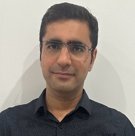
 Dr Behzad Kiani
 Dr Robert Bergquist
 Dr Sherif Amer