Skip to main content
Menu
GnosisGIS
Home
Our Newsletter
GnosisGIS
Home
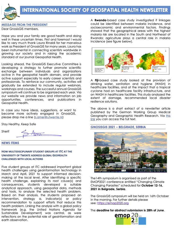
Our Newsletter
Our Newsletter
OUR NEWSLETTER
Current and past issues
Spring 2024
Winter 2021
Spring 2021
Fall 2020
Spring 2020
Fall 2019
Spring 2019
Winter 2018
Spring 2018
Summer 2018
Winter 2017
Spring 2017
Winter 2016
Summer 2016
Winter 2015
Fall 2015
Spring 2015
Receive our newsletter by e-mail
Register